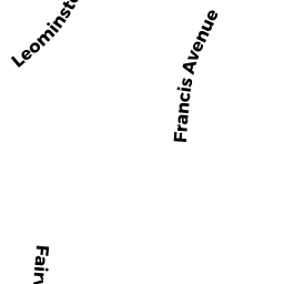
25 FRANCIS AVE
Owner Information
BRZOZOSKI, JUSTIN A & LAURA Q
21 FRANCIS AVE
LUNENBURG, MA 01462


Property Details
25 FRANCIS AVE is classified as a Developable Residential Land (Vacant land).
25 FRANCIS AVE is valued at $113,200. The land is valued at $113,200 and the structures are valued at $0.
This property is in Zone RA. Confirm with local Zoning Board authorities to ensure there are no overlays or other easements on this property.
The most recent deed for 25 FRANCIS AVE is recorded at the local registrar in Book 9159, Page 144. 25 FRANCIS AVE was last sold on Wednesday, September 5, 2018 for $100,500.
Assessment data from fiscal year 2021.
Flood Data
According to the FEMA National Flood Hazard Layer, this property does not appear to be in a flood zone. It may also be in an area not yet reviewed. Nonetheless, confirm this information prior to taking any action.
To view the flood hazards around this property, create a FEMA "Firmette" Map of the area around 25 FRANCIS AVE.
Broadband Internet Providers
| Provider | Type | Bandwidth (mbps) | |
|---|---|---|---|
| VSAT Systems, LLC. | Satellite | 2 | 1 |
| HughesNet | Satellite | 25 | 3 |
| Verizon New England Inc. | DSL | 15 | 1 |
| T-Mobile | Fixed Wireless | 25 | 3 |
| GCI Communication Corp. | Satellite | 0 | 0 |
| Comcast | Cable | 1000 | 35 |
| Viasat Inc | Satellite | 100 | 3 |
Broadband service provider data from December 2020.
Adjacent Properties
- 160 LANCASTER AVE LT 1
Single Family Residential owned by MENDOZA, JEFFREY L TRUSTEE - 11 FRANCIS AVE
Single Family Residential owned by SHAW, CHRISTOPHER M & - 21 FRANCIS AVE
Single Family Residential owned by BRZOZOSKI, JUSTIN A & LAURA Q - 38 FRANCIS AVE
Single Family Residential owned by ST GEORGE, THOMAS J & MERIDITH J - 65 FAIRVIEW RD
Single Family Residential owned by MORGAN, ANTHONY KONARD & MEREDITH KATE